 “Had a map been drawn . . . of Mr. Smith’s movements through the streets of New-York. . . a tangled hydra indeed would have been revealed,” begins the second chapter of Francis Spufford’s book Golden Hill (53). As my fellow Junto reviewers have discussed, Spufford’s exhilarating read follows Mr. Smith through the escapades and perils of mid-eighteenth-century New York as he attempts to convince those he encounters of his “credit worthiness.” As he meanders through the tangled web of city streets, Smith’s journey from the island’s southern tip to its northern outposts is filled with adventures and twists at every turn. The reader soon learns that many of the men and women he encounters have secrets to hide. There is much to like about Golden Hill. For this urban historian, one of the most enjoyable aspects is the book’s sense of place. Continue reading
Tag Archives: maps
The Month in Early American History
![]() Rise and shine, it’s time to relaunch our regular(ish) roundup of breaking news from early America. To the links!
Rise and shine, it’s time to relaunch our regular(ish) roundup of breaking news from early America. To the links!
First up, enjoy a walk through life after the American Revolution with this podcast series charting the life and times of William Hamilton of The Woodlands, who “made the estate an architectural and botanical showpiece of early America.” Or put presidential parades in historical context, via Lindsay Chervinsky’s essay on George Washington’s reticence for public pomp and grandeur: “Why, then, did Washington, a man intensely proud of his military service and revered for it, reject the trappings of military honor?” In conference news, the Omohundro Institute of Early American History and Culture unveiled the program for next month’s meeting. Elsewhere in the blogosphere, check out John Fea’s reflections on a decade(!) of posting, and what it means to teach “Public History for a Democracy.” Or flip through the newly digitized papers of polymath Benjamin Franklin. Continue reading
The Many & the One
 Like many, Amos Doolittle struggled to turn in a decent first draft of American history. The 21 year-old engraver, later known as the “Paul Revere of Connecticut,” arrived in Lexington and Concord shortly after April 1775. Anxious to capture the battles’ action and aftermath, he chatted with local residents. He sketched terrain. For Doolittle, a trained silversmith, it was a chance to experiment with a craft he had yet to master. Part of what he produced, a set of four views storyboarding the “shot heard round the world,” hangs in the Boston Public Library’s new exhibit, “We Are One: Mapping America’s Road from Revolution to Independence.” By Doolittle’s lights, Massachusetts makes for a furious and frenzied tableau: gusts of redcoats’ gunpowder hazing the sky, and colonial ranks splintering on the advance. On the American side, it is hardly a picture of union. Patriots scatter, racing blindly to frame’s edge. In his rough draft of Revolution, Amos Doolittle demands that we unlock all hopes of what might come next. Continue reading
A Beginner’s Guide to Mapping Early America with Basic GIS
 Over the past couple years, friends have asked me a lot about maps and mapping software—questions I probably have no business fielding. I’m not truly formally trained in GIS, I’ve picked up a lot of things online, from books, in workshops, but mostly through trial-and-error, and half the time I still prefer to draw my maps by hand. (Yes, I like to draw.) It’s sort of like the four-eyed leading the blind.
There’s a reason, though, that my friends have few other places to turn. Workshops at universities, as well as many guides online, are still largely geared towards those working on more contemporary history, and to those looking to manipulate census and other large data sets. For those of us working on colonial America—especially those working on frontiers, borderlands, and native grounds—our materials rarely support this kind of work.
As I thought about my post the last couple days, I realized I wanted to write something less to those also working on spatial-intensive projects, and something more for those—like my friends—looking to find quick and simple ways to add maps to presentations and papers. In other words, those who aren’t about to download ArcGIS, run windows on their mac, enroll in a series of workshops, lose days (weeks and months) to inputting vector and raster data, and become geospatial pros. Those who are more interested in manipulating a historic map than creating a new one from historic data. Casual mappers and prospective weekend warriors of geohistorical analysis, this is for you. Continue reading
The Week in Early American History
 Constitution Day Edition.
How did you celebrate Constitution Day on Wednesday? If you’re a politician on Capitol Hill, and didn’t answer either “by showing off my pocket-sized edition” or “standing near an oversized facsimile of my favorite amendment with text selectively crossed out to illustrate the imagined dangers posed by my political opponents,” then shame on you. Speaking of those pocket-sized editions, the Washington Post profiled Zeldon Nelson, the Idaho farmer and chief executive of the National Center for Constitutional Studies who sells them for just over a dollar a piece. Continue reading
Up to Code
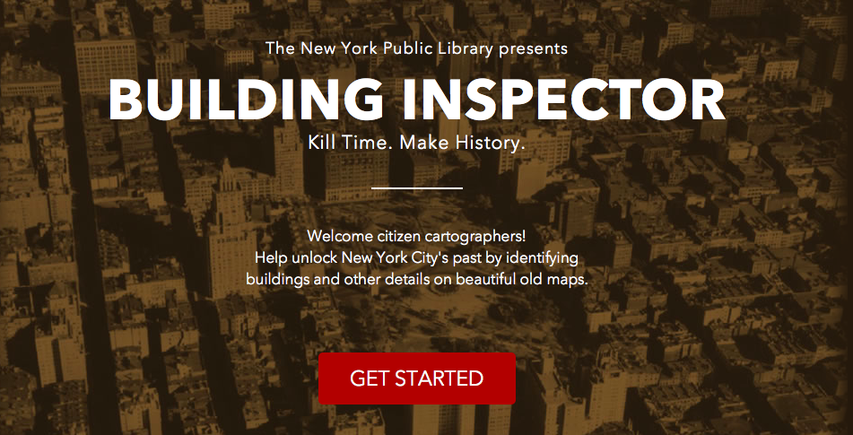
Today, The Junto chats with David Riordan, Product Manager of NYPL Labs, about Building Inspector, a crowdsourced digital project that invites citizen cartographers to “help unlock New York City’s past by identifying buildings and other details on beautiful old maps.” Read on about the Vectorizor, how you can contribute to The New York City Space/Time Directory, and how NYPL is making the “Google Maps of the past.”
Continue reading
The Week in Early American History
 Welcome to your weekly roundup of early American history headlines. Now that you’ve aced your presidential history knowledge, and reviewed this reading list of their lives, it’s on to the links! Continue reading
Using Local History in the Survey: City Streets
 A recent conversation with Joe, Ken, and Michelle Moravec has me thinking about ways to use local history in a US survey course. Right now, Michelle and I have it easy; we’re both teaching in greater Philadelphia. It doesn’t take a lot of creativity to find ways to call out local attractions in class. (I can even display a map showing my campus smack in the middle of the Battle of Germantown.) But what about local history in general? How can we demonstrate that history is experienced in particular places, and that every place, at least potentially, has a history?
The Week in Early American History

‘TWEAH, two nights before Christmas, when thr’out the blog roll
Not a creature was stirring, not even a troll;
The grades were all posted to Blackboard with care,
In hopes that strong evals soon would be there;
The grad students were nestled all snug in their beds,
While visions of fellowships danc’d in their heads,
And Ben Park in his ‘kerchief, and I in my cap,
Had just settled our brains on an early Americanist recap.
Rethinking the Early American Map
 It’s time we remake the North American map.
Open up most any early American history book and flip to the list of tables and figures. Chances are you’ll find—if provided—maps devoid of almost any indigenous peoples. If the book is more recent, perhaps instead you’ll find that the author included two maps: one of European settlements, and one of Native American peoples. Or, just maybe, you happen to have on hand one of the few books to merge all of these together. But look closely and see if you can find the usual tension—an unbalance resulting from the projection of European empire on one hand, and the illustration of limited, isolated, scattered indigenous nations on the other.
How can so many maps of colonial North America display European power and political influence, but not do the same for American Indian polities and groups?
Maybe the better question is, how can we overcome our own historiographical strictures and the limitations of seventeenth and eighteenth-century maps to better portray the American landscape?
